

Newsletter
Sign up and stay in-the-know about The Crowd & The Cloud and the world of citizen science.
#CrowdCloudLIVE After each episode's WORLD premiere in April, show host, producer, and people seen on the show participated in post-premiere roundtable discussions. Viewers like you listened in, asked questions, and were able to dive deeper into the power of Citizen Science.
Watch the recorded Facebook Live events now. Discover more about how Citizen Science is revolutionizing the ways we gather, analyze, and utilize the data that fuels scientific research, discovery, and community action.
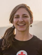
I am Jenelle Eli and I'm on the International Communications Team with the American Red Cross.
What were some of the big things that were a real challenge for the Red Cross right after the Nepal earthquake?
The geography of Nepal really created a lot of challenges for disaster responders. Lots of people live in small villages that are only accessible by foot and a lot of those pathways were actually wiped away by the earthquake and resulting mudslides.
Can you tell us what it was like going out to the town of Namtar?
We traveled to Namtar, a village far outside Kathmandu where people were affected by the Nepal earthquake. We took some serious winding roads where your car gets quite close to the edge. Then we hit a dirt road, it's downhill, it's dusty, there are just rocks everywhere and we had to go so slow. It's the kind of road that makes you think: would it just be faster to walk? It's also the kind of road, if there are two cars coming in different directions, they have to be really creative to figure out how they're going to get around one another!
The population center, the kind of downtown of Namtar, that's one thing. But there are little villages all around there that are only accessible by foot. We went to rice paddies and we walked through these terraced hills, and on the way we saw chickens, goats, bulls and people making baskets, just living their lives. But we were able to reach the top of this hill to reach a village that's maybe only 25 households, where their water source was cut off after the earthquake. Here the Red Cross is helping to install a water project.
How did you even know this place exists? It's not exactly something you just look up on your average map!
Before the earthquake, Kathmandu was pretty well mapped. But districts and rural villages outside of Kathmandu were not necessarily on the map. So in order to know where to get help to people in need, we needed to first put those people on the map and see where they were living. So something like OpenStreetMap was really invaluable to disaster responders like the Red Cross.
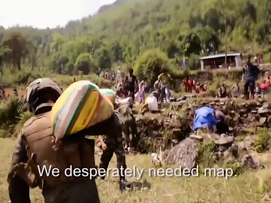
Soldiers deliver disaster relief in rural Nepal.
It was useful to know there were people up there who needed help. But what was even more useful was to know how to get there. Because, you know, you can see where people need help, but if you don’t know the footpath to take or you don’t know what size vehicle you can take in there, it's useless.
Mapping is still going on today, right? It was more helpful right after the earthquake, but even a year later, OpenStreetMap is still mapping these same villages. Can you talk about how it's being used now and what changes you're seeing?
Data from OpenStreetMap (OSM) was really vital to disaster responders during the Nepal earthquake. It allowed us to get the right aid to the right people quickly. But OSM data and its usefulness doesn't end when a disaster ends. We're still using OpenStreetMap today. I believe the water project will have something like 11 taps so we were able to map exactly where the water tank is and where the 11 taps are being installed. So this is not only helpful for the community to know where the taps are, but it also gives the community and disaster responders a point of comparison in case another disaster happens.
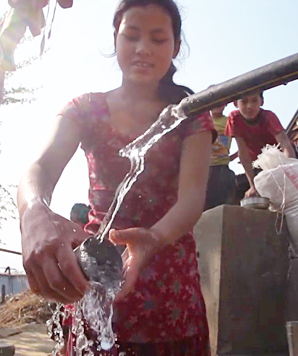
OSM helps plot where water taps are situated in rural Nepalese villages.
What's amazing about this OSM data is that it's available to everybody. It's available to disaster responders, but also all of the community as well. If something breaks with the water taps or maybe they want to install more, they have access to this map, this free and editable map, just like anybody else.
From your perspective, what are some of your favorite things that you experience with this?
This was my first time in Nepal and I'm not only checking out the disaster work that's been done by the Red Cross, but I'm meeting tons of people that are impacted by this earthquake. And, you know, we see disasters on TV and we want to help people. I think that's an amazing instinct and the way people help is super useful and impactful. But it's also really lovely to hike up to these villages where I can't even believe somebody lives that far up a mountain and I meet people who are so tough and so resilient. They are so thankful for the help disaster responders have given them, but they are also doing a great job of helping themselves. They're resilient. They have hope for the future. They are able to identify what they need and start working toward that themselves and then also asking for help when they need it. It's just been amazing to meet really tough, resilient families, especially while in Nepal.
Victims of the 2015 earthquakes clear away rubble from what was once their home in Kathmandu.
I met these really strong women with infants the other day and they are not only having to take care of their families everyday, cook and work in the fields and all this, but they're also rebuilding their homes. Every single one of them lost their homes. But they're just living their lives and trying their best. I can see in their faces that they have hope for the future and smiles on their faces despite the hardships that they're facing.
Jenelle, can you tell us specific example of how OpenStreetMap helped your team?
Right after the earthquake happened, something like 2,000 volunteers jumped in to help make edits to OpenStreetMap in the first 48 hours. The maps that they helped create were so vital to disaster responders like the Red Cross because they allowed us to see things like the size of roads so we knew what size vehicles to take in or whether we need to hike in supplies. They allowed us to see the distance between airports, warehouses and distribution hubs. Even if those distances you could calculate them before the earthquake, there were so many changes after the earthquake due to shifting land or mudslides or blocked roads. This gave our disaster responders the ability to check these updates every morning before they started off to go deliver relief supplies. People checked these maps every day and were able to see (a) whether they were going to the right communities that were the most impacted and (b) whether they were overlapping with any other agencies.
The amazing thing about these maps is that they are free, editable and available to anybody online. These maps aren't just available to the Red Cross or to people who have made the edits, they are available to humanitarian organizations and disaster responders of every shape and size. So people can look online and have the same information as other organizations. This is really essential because if disaster responders aren't coordinated, it means they could have duplication of efforts or gaps in delivery of essential services. So these maps really allow everyone to be on the same page.
When a big disaster like the Nepal earthquake happens, the Red Cross gets inquiries from all over asking what people can do to help. Some people are able to be sent over as disaster responders. Some people are able to donate money. What's amazing about OpenStreetMap is that people can help right away by making edits to OpenStreetMap. So within 48 hours, 2,000 volunteers made edits to OpenStreetMap to help disaster responders on the ground deliver relief supplies. That is an astounding amount of edits and an astounding amount of time.
Disaster responders don't sleep a lot, but they do have to sleep at some point. It's nice for them to be able to wake up in the morning and have edits to their maps.
When you're walking around using the OpenStreetMap in these situations, is it usually physical paper, or is it on a tablet?
Relief workers have told me about how they can take the OSM data and upload it onto their GPS every morning. This allows them to navigate to the places they need to go more easily, because this data shows things like mudslides, bridges that are out, maybe if a road is blocked by telephone poles or fallen coconut trees. So to be able to give directions to drivers in a way that gets you to the place you need to be most efficiently, it's amazing.
What are you going to take away from this experience?
I have a colleague who says that if you've seen one disaster, you've seen one disaster. I think being in Nepal has really brought that alive for me. You know, we see on the news that when a big disaster happens that this many houses were destroyed, this many people passed away, and this many roads are inaccessible. To be able to be here and travel to Nepal and really meet the people who were affected by the earthquake, it really just brings it home that everybody's different. Everybody's needs are different, every landscape is different. And it's been a really great opportunity to come here and to meet people who are rebuilding and living with hope, just living their lives and excited to rebuild.
We live in a world where we read the news every day, and there's bad news stories, but what I really love about the mapping story is that it's people coming together from a really positive place and working together to help. It could be to help their own neighborhood or it could be to help somebody all the way across the world. And that's what really inspires me about maps is that people are coming together to help one another and to also take control of their own data.
I love that these maps are free and editable so that they are available to organizations and available to disaster responders, but more importantly they are available to the community that's being mapped. So they have this data forever. They have people all the way across the world to thank for that and I just think that's really cool.
